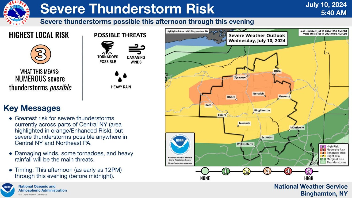
The National Weather Service warned this morning of damaging winds, heavy rain and even the possibility of a tornado in Cortland and surrounding counties as the remains of Hurricane Beryl move into the Great Lakes region and New York.
Expect a band of storm cells this morning, and another this afternoon. Binghamton-based forecasters expect 1 to 1.5 inches of rain to fall, and issued a flood watch for Onondaga, Oneida and Madison counties, but not Cortland, Tompkins or Cayuga.
A tornado watch has been issued across much of upstate New York through 9 p.m.
Gov. Kathy Hochul mobilized state resources and urged caution. Heavier rain starts this afternoon and continues tonight into Thursday, particularly in Western New York, the Finger Lakes, Southern Tier, Central New York, Mohawk Valley, Mid-Hudson, Capital Region and North Country. Flash flooding is a distinct possibility, mostly in the North Country, she said.
“New York is no stranger to the devastating effects that storms can have on our communities,” Governor Hochul said. “My administration will be closely monitoring the weather impacts and we encourage New Yorkers to remain vigilant and watch the weather forecast closely.”
The governor’s office suggested having a flashlight and extra batteries on hand, a battery-operated radio, first aid kid, emergency food and water, a non-electric can opener and essential medicines.
If you encounter a flash flood, it advises, do not try to drive through a flood road; turn around. If water rises rapidly around you in your car, abandon the vehicle. Two feet of moving water will float a car, and just a couple of inches will move a person.


